Past Projects
.jpg/:/cr=t:0%25,l:0%25,w:65.71%25,h:65.71%25/rs=w:1023,cg:true,m)
Screenshot from a 3D Laser Scanning project in NYC. Elevation details from the 3D Point Cloud of the existing rock formations.
The point cloud was used to calculate excavation work volume and to coordinate architectural design intent with the ongoing field excavation work.
3D Laser Scanning for a project in NYC. Elevation from the 3D Point Cloud of the existing rocks.
You can see the survey control points and elevation marks, used for accurate point cloud geo-referencing and coordination with the design intend BIM and construction VDC teams.
.jpg/:/cr=t:0%25,l:0%25,w:100%25,h:100%25/rs=w:1023,cg:true)
3D Laser Scanning for a project in NYC. Plan View detail from the 3D Point Cloud of the excavation work.
The white circles are the no data points, shadow areas under the laser scanner tripod.
We have provided also Robotic Total Station Construction Layout for the foundations concrete work on this project.

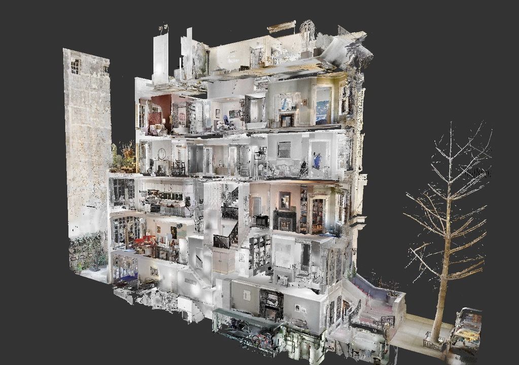
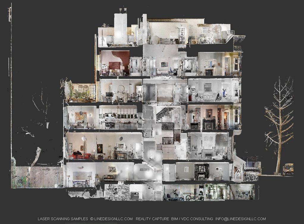
Another Reality Capture project for a private residence - eight levels townhouse in New York City. The project was captured with Faro Focus S 350 Laser Scanner.

Vertical Section screenshot from the 3D Point Cloud of a Townhouse project in NYC. The Point Cloud provids accurate representation of the existing conditions in HDR Colors.

Highlighted Projects

Coming Soon
Check Again Soon for Selected Projects from our Reality Capture, Laser Scanning, Building Information Modeling, Virtual Design and Construction Portfolio.

Coming Soon
Check Again Soon for Selected Projects from our Reality Capture, Laser Scanning, Building Information Modeling, Virtual Design and Construction Portfolio.

Coming Soon
Check Again Soon for Selected Projects from our Reality Capture, Laser Scanning, Building Information Modeling, Virtual Design and Construction Portfolio.
Copyright © 2023 LINE DESIGN LLC - All Rights Reserved.
This website uses cookies.
We use cookies to analyze website traffic and optimize your website experience. By accepting our use of cookies, your data will be aggregated with all other user data.
.jpg/:/cr=t:0%25,l:7.81%25,w:84.38%25,h:84.38%25/rs=w:1023,cg:true,m)